
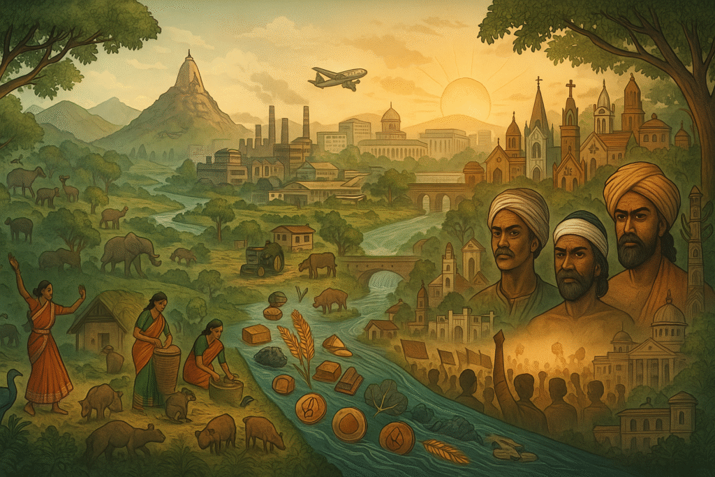
Tucked away in eastern India lies Jharkhand—a land of dense forests, rugged plateaus, sacred peaks, and a resilient people who fought for their own identity. Created in 2000, Jharkhand is one of India’s youngest states, born from decades of struggle by its indigenous communities. But its story goes far beyond politics—it’s a tale of nature, culture, and the will to preserve identity.
Where is Jharkhand?
Jharkhand shares its borders with five Indian states:
- Bihar to the north
- West Bengal to the east
- Odisha to the south
- Chhattisgarh to the west
- Uttar Pradesh to the northwest
The capital city is Ranchi, and as of the 2011 census, Jharkhand had a population of nearly 33 million people, spread across an area of 74,677 square kilometers.
The Road to Statehood
After India gained independence in 1947, Jharkhand remained part of Bihar. But for the tribal communities who make up a significant portion of the population, development was elusive. Adivasis (Scheduled Tribes) saw little improvement in their social or economic conditions.
In the 1980s, tribal leaders launched a strong movement for statehood. Over time, even non-tribal communities joined the cause. By the 1990s, the demand for a separate state had become impossible to ignore. And finally, in 2000, the Indian government created Jharkhand.
A Land of Plateaus and Sacred Peaks
Jharkhand’s landscape is dominated by the Chota Nagpur Plateau, part of the larger Deccan Plateau. This ancient formation is made up of hills, valleys, and flat-topped plateaus—locally known as pats.
Some key geographical features:
- Hazaribag and Ranchi Plateaus average around 2,000 feet (610 m) in elevation.
- The Parasnath Hill (4,477 feet or 1,365 m) is the highest point—sacred to both Jains and Santhals.
- Major rivers like the Damodar, Subarnarekha, Brahmani, and Son carve through the plateau, shaping the state’s drainage system.
Soils range from sandy in the Damodar valley to heavier red soils on the plateau—perfect for forest growth and agriculture.
Seasons and Climate
Jharkhand experiences three distinct seasons:
- Winter (Nov–Feb): Cool and pleasant, with temperatures ranging from 10°C to 20°C.
- Summer (Mar–June): Hot and dry, with May being the hottest month (up to 37°C).
- Monsoon (June–Oct): Heavy rainfall dominates, especially in July and August. Annual rainfall ranges from 1,000 mm to 1,500 mm.
Forests and Wildlife: A Green Treasure
More than 25% of Jharkhand is forested, especially on the Chota Nagpur Plateau. These forests are not only a natural treasure but also a cultural lifeline for tribal communities.
Key Flora:
- Sal (Shorea robusta): A valuable timber tree
- Mahua (Madhuca longifolia): Edible flowers used to brew traditional liquor
- Asan (Terminalia tomentosa): Supports the sericulture industry
- Bamboo and bhabar grass: Essential for paper-making
Fauna Highlights:
- Hazaribag Wildlife Sanctuary: Home to Bengal tigers, leopards, elephants, and more
- Smaller mammals, birds, and reptiles thrive in the forests and rivers
People and Culture
Jharkhand is a tapestry of cultures, languages, and beliefs. Tribal communities—including the Santhal, Munda, Oraon (Kurukh), Ho, and Kharia—make up nearly 40% of the population.
Religious Diversity:
- Majority: Hinduism
- Minorities: Christianity (esp. among Munda, Oraon, Kharia), Islam, and indigenous religions
Languages Spoken:
- Hindi, Urdu, and Bihari dialects (Bhojpuri, Magadhi, Maithili)
- Santhali, Ho, Munda (Austroasiatic family)
- Kurukh/Oraon (Dravidian language)
Urban vs. Rural
Despite its mineral wealth and industrial development, Jharkhand is still largely rural, with only about 10% of the population living in cities. Most settlements are scattered villages nestled in valleys, around forests, or near industrial belts.
Major Cities:
- Ranchi: Capital and cultural hub
- Jamshedpur: Industrial city, home to Tata Steel
- Dhanbad: Coal capital of India
- Bokaro: Major steel-producing city
Tribal communities are concentrated in regions like Ranchi, Dumka, and East and West Singhbhum.
Economy & Industry
- Economic Focus: Since statehood in 2000, Jharkhand has prioritized sectors like IT, transportation, agriculture, infrastructure, and handicrafts.
- Industrial Hubs: Industrial Area Development Authorities operate in Adityapur, Bokaro, and Ranchi for land acquisition and infrastructure development.
- Cottage Industries: Predominantly artisan-based industries—sericulture, handloom, lac, pottery, woodwork—are common in Hazaribag, Ranchi, Singhbhum, and Jamshedpur.
- Major Industrial Cities:
- Jamshedpur – Steel hub (Tata Steel)
- Ranchi – Machinery and engineering
- Bokaro – Steel production
- Chaibasa – Cement production from slag
Agriculture & Livestock
- Agricultural Assets: Fertile land, groundwater, and a moderate climate support agriculture.
- Animal Husbandry Initiatives:
- Selective sheep-breeding in Chatra for better mutton/wool yield.
- Goat farming prominent in Dumka, Deoghar, Godda, and Chatra.
- Pig farms located in Kanke, Saraikela, and Jamshedpur.
Mineral Resources & Power
- Chota Nagpur Plateau: Richest mineral belt in India.
- Major Minerals: Produces India’s total output of copper, kyanite, pyrite, phosphate; significant iron ore, mica, bauxite.
- Coalfields: Located in Damodar Valley; major source of India’s coking coal.
- Power Infrastructure:
- Damodar Valley Corporation (DVC) manages thermal/hydro plants.
- Serves both Jharkhand and West Bengal via a shared power grid.
Transportation
- Roads: National highways like the Grand Trunk Road run through the state, but all-weather roads reach fewer than half the villages.
- Railways: The Kolkata–Delhi line (since 1864) crosses Jharkhand, with major freight centers in Ranchi, Bokaro, Dhanbad, Jamshedpur.
- Air Transport: Ranchi is served by scheduled flights.
- Waterways: No longer significant for transport.
Government & Administration
- Governance Structure:
- Governor (appointed by India’s President)
- Chief Minister leads the Council of Ministers
- Legislature: Bicameral – Vidhan Sabha (Assembly) and Vidhan Parishad (Council)
- Judiciary: High Court in Ranchi; district and subordinate courts exist.
- Administrative Units: Districts headed by Deputy Commissioners, assisted by Superintendents of Police.
Health Infrastructure
- Facilities: Over 500 medical centers; large hospitals in Ranchi, Dhanbad, and Jamshedpur.
- Specialized Care: TB, leprosy, and psychiatric treatment centers near Ranchi; cancer hospital in Jamshedpur.
- Common Ailments: Respiratory issues, diarrhea, dysentery; low occurrence of cholera and malaria.
- Medical Systems: Includes allopathy, Ayurveda, Unani, and homeopathy.
Education
- Literacy Growth: Significant improvement since the 1990s; surpassed 50% by early 2000s.
- Major Universities:
- Ranchi University (1960)
- Birsa Agricultural University (1981)
- Sido Kanhu Murmu University (1992)
- Vinoba Bhave University (1992)
- Technical & Research Institutes:
- Indian School of Mines, CIMFR, BIT Mesra, Xavier Labour Relations Institute
- Indo-Danish Tool Room – key training center in Jamshedpur