
“Explore the comprehensive district-wise profile of Jharkhand, featuring detailed insights into demographics, geography, industries, tourism, literacy, and key facts—essential for competitive exams like JPSC, JSSC, UPSC, and state-level GK preparation.”
Ranchi District Overview
Administrative Profile
- Division: South Chotanagpur (दक्षिणी छोटानागपुर प्रमंडल)
- Formation: 1899
- Headquarters: Ranchi
- Area: 5,097 sq. km
- Subdivisions:
- 02: Ranchi Sadar & Bundu
- Blocks:
- 18 Blocks: Ratu, Kanke, Mandar, Namkum, Bero, Lapung, Chanho, Ormanjhi, Angara, Nagri, Khalari, Rahe, Itki, Silli, Bundu, Tamar, Sonahatu, Budhmu
- Assembly Constituencies:
- 07: Ranchi, Hatia, Kanke, Mandar, Tamar, Silli, Khijri
- National Highways:
- NH 20, 39, 43, 143AG
Demographic Data
- Total Population: 29,14,253
- Decadal Growth Rate: 23.9%
- Population Density: 572/sq. km
- Sex Ratio: 949 ♀ per 1000 ♂
- Child Sex Ratio: 938
- Literacy Rate: 76.06%
- Male: 84.26%
- Female: 67.44%
- Highest population and literacy rate among all districts
Important for exams
Geography & Natural Resources
- Major Rivers:
- Swarnarekha River, Dakshini Koel River
- Minerals:
- Coal, Limestone, Fire Clay, Granite, China Clay, Zinc, Tin, Asbestos, Thorium, Ilmenite
- Industrial Zones:
- Ormanjhi, Namkum, Angara, Silli
Major Industries
- Heavy Engineering Corporation Ltd. (HEC) – Ranchi
- Indian Aluminium Company Ltd. – Muri
- ACC Cement Ltd. – Khalari
- Usha Martin Ltd. – Namkum
- Garden Reach Shipbuilders & Engineers Ltd.
Major Tourist Spots
- Waterfalls:
- Hundru Falls, Jonha (Gautamdhara) Falls, Dassam Falls, Sita Falls
- Religious Sites:
- Jagannath Temple, Pahari Mandir, Suryamandir, Deori Temple
- Others:
- Tagore Hill, Rock Garden, Nakshatra Van, Ratu Fort, Siddhu Kanhu Park, Yogoda Math Ashram, Pithoria (Well on Hill)
Frequently asked in state exams
- Tagore Hill, Rock Garden, Nakshatra Van, Ratu Fort, Siddhu Kanhu Park, Yogoda Math Ashram, Pithoria (Well on Hill)
Educational & Research Institutions
- Ranchi University
- Dr. Shyama Prasad Mukherjee University
- Birsa Agricultural University
- Central University (Brambe)
- National University of Study and Research in Law (NUSRL)
- Birla Institute of Technology (BIT), Mesra
- Indian Lac Research Institute (Namkum)
- RINPAS
- Ranchi Institute of Medical Sciences (RIMS)
- Xavier Institute of Social Science (XISS)
- Indian Institute of Management (IIM), Ranchi
- Judicial Academy, Ranchi
- S.K. Institute of Public Administration
- Defence University
Unique Highlights
- Most populated district of Jharkhand
- Highest SC population
- Ranchi was the summer capital of unified Bihar
- _Tagore Hill:
- Home to Jyotirindranath Tagore (Rabindranath Tagore’s elder brother)
- Built steps, a mandap, and named the site “Shantalaya” & “Satyadham”
- Final rites performed at Harmu Ghat
- Earlier known as Richi Buru_
- _Yogoda Math Ashram:
- Founded by Paramhansa Yogananda in 1917–18
- Established with land donated by Maharaja Manindra Chandra Nandi_
- _McCluskieganj:
- Only Anglo-Indian village in the world
- Established by Ernest Timothy McCluskie in 1933
- Land acquired from Ratu Maharaj (10,000 acres)
- Once invited ~2 lakh Anglo-Indians; now only ~20 families remain_
Khunti District Overview
Basic Information
- Formed on: 12 September 2007 (from Ranchi district)
- Jharkhand’s 23rd district
- Nickname: City of Waterfalls
- Area: 2,535 sq. km
- Headquarters: Khunti
- Population: 5,31,885
- Decadal Growth Rate: 22.32%
Special Features
- Highest tribal population percentage in Jharkhand
- Presence of major industries like HEC, CCL, and SAIL headquarters nearby
- Significant Assembly Constituencies: Torpa, Simdega, etc.
Etymology and Cultural Notes
- Origin of the name “Ranchi”:
- From “Archi” (forest) – folk belief
- From “Aranchi” (small stick in Mundari) – as per Sharad Chandra Roy
- From bird “Richi” found in Pahari Mandir area – another local lore
Important Takeaways for Competitive Exams
- Ranchi: Highest population, literacy rate, and educational institutions
- Khunti: Known for waterfalls and tribal population
- Tagore Hill, Yogoda Ashram, McCluskieganj are historical and exam-focused locations
- Ranchi was once the summer capital of Bihar
- NH 20, 39, 43, 143AG pass through Ranchi
- Major rivers: Swarnarekha and Dakshini Koel
- Minerals: Coal, China Clay, Thorium, etc.
Khunti District Overview
Administrative Details
- Formation Date: 12 September 2007 (carved out from Ranchi)
- District No.: 23rd district of Jharkhand
- Nickname: City of Waterfalls
- Headquarters: Khunti
- Area: 2,535 sq. km
- Sub-division: 01 (Khunti)
- Blocks: 06 – Khunti, Torpa, Murhu, Arki, Karra, Rania
- Assembly Constituencies: 02 – Khunti, Torpa
- National Highways: NH 20, 143D, 143AG
Demographics
- Population: 5,31,885
- Population Density: 210 persons/sq. km
- Sex Ratio: 997 ♀ per 1000 ♂
- Child Sex Ratio: 964
- Literacy Rate: 63.86%
Geography & Resources
- Major Rivers: Kanchi, Karo, Karkari, Banai
- Major Minerals: Limestone, Building Stone
Tourist Attractions
- Panchghagh Falls, Rani Falls
- Birsa Mrig Vihar Deer Park
- Ulihatu Hill & Village – Birthplace of Birsa Munda
- Dombari Buru Hill – Historical site of Birsa Munda’s Ulgulan Movement (1899)
- British opened fire on hundreds of villagers here during a tribal meeting
- Many tribal people were killed, Birsa escaped
Archaeological Importance
- Sakal village – Ancient remains: burnt brick houses, red clay pots, coins, iron tools
Gumla District Overview
Administrative Details
- Formation Date: 18 May 1983
- Headquarters: Gumla
- Area: 5,360 sq. km
- Subdivisions: 03 – Gumla, Chainpur, Basia
- Blocks: 12 – Gumla, Sisai, Bishunpur, Chainpur, Ghaghra, Dumri, Basia, Raidih, Kamdara, Bharno, Palkot, Albert Ekka
- Assembly Constituencies: 03 – Gumla, Sisai, Bishunpur
- National Highways: NH 43, 143, 143A, 143B, 143D
Demographics
- Population: 10,25,213
- Population Density: 191 persons/sq. km
- Sex Ratio: 993
- Child Sex Ratio: 963
- Literacy Rate: 75.55%
- ST Population Percentage: 73.25% Highest in Jharkhand
Geography & Resources
- Major Rivers: South Koel, Sankh
- Minerals: Bauxite, Limestone, Lead, Quartz, Kyanite, Iron
Religious & Tourist Sites
- Religious Sites: Shiva Temple, Amreshwar Dham
- Tourist Spots:
- Ghaghra Falls
- Hepad Falls
- Premaghagh Falls
- Navratnagarh Fort
- Palkot Palace
- Nagpheni Palace & Cave
- Cultural Belief: Gumla is believed to be the birthplace of Lord Hanuman
- Mythology: Risyamuk Hill mentioned in Ramayana is situated here
- Etymology: Derived from “Gau-Mela” (Cow Fair)
Simdega District Overview
Administrative Details
- Formation Date: 30 April 2001 (carved from Gumla)
- Headquarters: Simdega
- Area: 3,774 sq. km
- Subdivision: 01 (Simdega)
- Blocks: 10 – Simdega, Kolebira, Bano, Bansjor, Jaldega, Bolba, Kurdeg, Pakartanad, Kersai, Thethaitangar
- Assembly Constituencies: 02 – Simdega, Kolebira
- National Highways: NH 143, 143D, 143H, 320G
Demographics
- Population: 5,99,578
- Population Density: 159 – Lowest in Jharkhand
- Sex Ratio: 997
- Child Sex Ratio: 969
- Literacy Rate: 67.99%
Geography & Resources
- Rivers: South Koel, Sankh
- Minerals: Quartz, Limestone
Tourist & Religious Spots
- Tourist Spots:
- Ghaghra Falls
- Hepad Falls
- Premaghagh Falls
- Navratnagarh Fort
- Palace at Palkot
- Nagpheni Palace and Cave
- Religious Places:
- Mahamaya Temple
- Anjandham Temple
- Tangi Nath Temple
Historical Notes
- Simdega was earlier known as “Biru Kaishalpur Pargana” under Raja Katang Dev
Lohardaga District Overview
Administrative Details
- Formation Year: 1983
- Headquarters: Lohardaga
- Area: 1,502 sq. km
- Sub-division: 01 (Lohardaga)
- Blocks: 07 – Lohardaga, Kisko, Senha, Peshrar, Kairo, Bhundra, Bhandra
- Assembly Constituency: 01 – Lohardaga
- National Highways: NH 39, 143A, 143AG
Demographics
- Population: 4,61,790
- Population Density: 307
- Sex Ratio: 985
- Child Sex Ratio: 970
- Literacy Rate: 67.61%
- Notable Facts:
- Least populated district
- Lowest Scheduled Tribe population
Natural Features
- River: South Koel
- Minerals: Bauxite, Clay
Religious & Educational Significance
- Religious Site: Vasudev Rai Temple
- Educational Institution: Government Ayurvedic College
Etymology & History
- Lohardaga means “Centre of Iron-makers”
- Mentioned in Akbar’s Ain-i-Akbari as “Qismat-e-Lohardaga”
Hazaribagh District Overview
Administrative Details
- Headquarters: Hazaribagh
- Area: 3,718 sq. km
- Sub-divisions: 02 – Hazaribagh & Barhi
- Blocks: 16 – Hazaribagh Sadar, Barhi, Barkagaon, Barkatha, Keredari, Chauparan, Padma, Ichak, Vishnugarh, Churchu, Tatijharia, Daru, Katkamsandi, Katkamsara, Chalkusha, Dadi
- Assembly Constituencies: 04 – Hazaribagh, Barhi, Barkagaon, Barkatha
- National Highways (NH): 19, 20, 522
Demographics
- Population: 17,34,495
- Population Growth Rate: 20.65%
- Population Density: 488
- Sex Ratio: 947
- Child Sex Ratio: 933
- Literacy Rate: 69.75%
Geography & Resources
- Major Rivers: Damodar, Barakar, Bhairavi
- Major Minerals: Coal, Limestone, Mica, Quartz, Fireclay, Felspar, Zinc, Tin, Tungsten, Iron
Educational & Training Institutes
- Vinoba Bhave University
- Indian Agricultural Research Institute (Barhi)
- Soil Research Institute
- Rice Research Institute
- Police Training Centre
- BSF Training Centre (Meru)
Tourist Attractions
- Hazaribagh Wildlife Sanctuary
- Salparni Lake
- Surajkund
- Ranamahal Hot Spring
- Konar Dam
- Chandrapura Hill
- District Nickname: “City of Thousand Gardens”
- Most Rainfall-Receiving District in Jharkhand
Ramgarh District Overview
Administrative Details
- Formation Date: 12 September 2007 (from Hazaribagh)
- Headquarters: Ramgarh
- Area: 1,341 sq. km (Smallest district by area)
- Sub-division: 01 (Ramgarh)
- Blocks: 06 – Ramgarh, Mandu, Patratu, Gola, Chitarpur, Dulmi
- Assembly Constituencies: 02 – Ramgarh, Mandu
- National Highways (NH): 20, 320, 419
Demographics
- Population: 9,49,443
- Population Growth Rate: 13.10%
- Population Density: 708
- Sex Ratio: 921
- Child Sex Ratio: 927
- Literacy Rate: 73.17%
Geography & Resources
- Major Rivers: Damodar, Konar, Bhairavi, Bokaro
- Major Minerals: Coal, Limestone, Fireclay, Felspar, Quartz
Tourist & Cultural Sites
- Rajrappa Waterfall
- Patratu Dam
- Chutupalu Valley, Lalki Valley
- Buddhist Stupa at Sitagadh Hill (4-faced)
- Mahudi Hill – Gupta Period Rock-cut Temple
- Barsa Pani, Padma Fort, Badhma Fort
- Maa Chhinnamastika Temple, Rajrappa
- Named after: Ram Singh’s father – Dalel Singh (king of Ramgarh)
Chatra District Overview
Administrative Details
- Formation Date: 29 May 1991
- Headquarters: Chatra
- Area: 3,718 sq. km
- Sub-divisions: 02 – Chatra & Simaria
- Blocks: 12 – Chatra, Simaria, Hunterganj, Itkhori, Tandwa, Pratappur, Lawalong, Pathalgada, Madhurkhanda, Kunda, Gidhaur, Kanha Chatti
- Assembly Constituencies: 02 – Chatra & Simaria
- National Highways (NH): 22, 522
Demographics
- Population: 10,42,886
- Population Growth Rate: 31.77%
- Population Density: 280
- Sex Ratio: 953
- Child Sex Ratio: 967
- Literacy Rate: 60.18%
Geography & Resources
- Rivers: Damodar, Barakar, Punpun
- Minerals: Coal, Mica, Limestone
Tourist & Religious Sites
- Rajrappa Waterfall
- Patratu Dam
- Chutupalu & Lalki Valleys
- Dumer-Sumer Waterfall
- Kolhua Hill (Lawalong)
- Gomaya, Matarganj
- Itkhori – Bhadrakali Temple
- Kowleshwar Temple
- Sahasrabuddha Temple
- Mahendrapal Inscription
- Highest Scheduled Caste Population % – 32.65%
- Second highest Forest Cover – 47.80%
- Smallest Parliamentary Constituency
Koderma District Overview
Administrative Details
- Formation Date: 10 April 1994
- Headquarters: Koderma
- Area: 2,540 sq. km
- Sub-division: 01 (Koderma)
- Blocks: 06 – Koderma, Satgawan, Domchanch, Markacho, Chandwara, Jayanagar
- Assembly Constituency: 01 (Koderma)
- National Highways: NH 20
Demographics
- Population: 7,16,259
- Population Growth Rate: 43.42% (Highest in Jharkhand)
- Population Density: 280
- Sex Ratio: 953
- Child Sex Ratio: 949
- Literacy Rate: 66.84%
Geography & Resources
- Rivers: Barakar, Sakri, Barsoti
- Minerals: Mica, Limestone, Quartz
- India’s Mica Capital
Tourist Attractions
- Tilaiya Dam
- Gautam Buddha Sanctuary
- Koderma Wildlife Sanctuary
Giridih District Overview
Administrative Details
- Formation Date: 4 December 1972
- Headquarters: Giridih
- Area: 4,962 sq. km
- Assembly Constituencies: (Not mentioned in content)
- National Highways: NH 20
Demographics
- Population: 24,45,474
- Population Growth Rate: 28.41%
Giridih District Overview
Administrative Details
- Sub-divisions: 04 – Giridih, Bagodar, Sariya, Dumri, Khori Mahua
- Blocks: 13 – Giridih, Bagodar, Dumri, Dhanwar, Jamua, Gandey, Deori, Gawan, Tisri, Pirtand, Birni, Bengabad, Sariya
- Assembly Constituencies: 06 – Giridih, Bagodar, Dumri, Dhanwar, Jamua, Gandey
- National Highways: NH 19, 114A, 522
Demographics
- Population Density: 493
- Sex Ratio: 944
- Child Sex Ratio: 942
- Literacy Rate: 63.14%
Geography & Resources
- Major Rivers: Damodar, Barakar, Sakri
- Major Minerals: Coal, Mica, Quartzite
Tourist Attractions
- Parasnath Hill
- Usri Waterfall
- Jharkhand Dham Temple, Madhuban Jain Temple
Key Facts
- India’s significant mica-producing district
- Industries like Bharat Mica Industries Pvt. Ltd.
- Famous pilgrimage: Parasnath (Jain site)
Bokaro District Overview
Administrative Details
- Formation Date: 1 April 1991 (from Giridih & Dhanbad)
- Headquarters: Bokaro
- Area: 2,883 sq. km
- Sub-divisions: 04 – Highest in Jharkhand
- Blocks: 09 – Chas, Bermo, Gomia, Chandanakiyari, Chandrapura, Nawadih, Kasmar, Petarwar, Jaridih
- Assembly Constituencies: 04 – Bokaro, Bermo, Gomia, Chandanakiyari
- National Highways: NH 18, 218, 320
Demographics
- Population: 20,62,330
- Population Growth Rate: 16.01%
- Population Density: 715
- Sex Ratio: 922
- Child Sex Ratio: 923
- Literacy Rate: 72.01%
Geography & Resources
- Rivers: Damodar, Konar, Khanjo
- Minerals: Coal
- Other Resources: Mica, Quartzite
Industries
- Tenughat Dam
- Bokaro Thermal Power Station (BTPS)
- India’s first planned industrial city
- Marafari – oldest settlement area
Tourist Attractions
- Jawaharlal Biological Park
- Nehru Park
- City Park
- Durgapur Hill
- Chandrapura Bird Sanctuary
Dhanbad District Overview
Administrative Details
- Formation Date: 24 October 1956
- Headquarters: Dhanbad
- Area: 2,040 sq. km
- Sub-division: 01 (Dhanbad)
- Blocks: 10 – Dhanbad, Nirsa, Baghmara, Tundi, East Tundi, Govindpur, Topchanchi, Baliapur, Kaliyasol, Egarkund Jharia merged into Dhanbad Municipal Corporation
- Assembly Constituencies: 06 – Dhanbad, Jharia, Nirsa, Baghmara, Tundi, Nirsa-Chirkunda
- National Highways: NH 18, 19, 218, 419
Demographics
- Population: 26,84,487 (Second highest in Jharkhand)
- Population Growth Rate: 26.17%
- Population Density: 1,316 (Highest in Jharkhand)
- Sex Ratio: 909 (Lowest in Jharkhand)
- Child Sex Ratio: 916 (Lowest in Jharkhand)
- Literacy Rate: 74.52%
Geography & Resources
- Rivers: Damodar, Barakar, Gobai
- Major Minerals: Coal, Quartz, Felspar, Fireclay, Thorium
Industries
- Fertilizer & Chemical (Sindri)
- Reliance
- Firebrick & Potteries (Chirkunda)
- Shalimar Wire Products (Jharia)
- Dhanbad Engineering Works (Kumardhubi)
- Hindustan Steel Ltd
- Over 250 industries in 25 sq. km area
Tourist Attractions
- Maithon Dam
- Panchet Dam
- Topchanchi Lake
- Tetulia Hot Spring
- Panchkot Fort, Jhariagarh Palace
Educational Institutions
- Indian School of Mines (IIT Dhanbad)
- Central Mining Research Institute
- Birsa Institute of Technology (Sindri)
- Dhanbad Law College
Palamu District Overview
Administrative Details
- Formation Date: 1 January 1892
- Headquarters: Medininagar (Daltonganj)
- Area: 4,393 sq. km
- Sub-divisions: 03 – Medininagar, Hussainabad, Chhatarpur
- Blocks: 21 – Highest among all districts
- Assembly Constituencies: 05 – Daltonganj, Hussainabad, Chhatarpur, Vishrampur, Panki
- National Highways: NH 39, 139
Demographics
- Population: 19,39,869
- Literacy Rate: 63.63%
Geography & Resources
- Rivers: North Koel, Amanat, Son
- Minerals: Coal, Fireclay, Limestone, Graphite, Iron, Lead, Silver, Zinc, Bauxite, Dolomite, Magnetite, Quartzite
Industries
- Japla Cement Factory
- Stick Soda & Chemicals (Bihar)
Tourist Attractions
- Palamu Wildlife Sanctuary
- Medinirai Fort
- Shahpur Fort
- Rohilla Fort
Educational Institutions
- Nilamber-Pitamber University
- National Oilseed Research & Development Institute
Garhwa District Overview
Administrative Details
- Formation Date: 1 April 1991
- Headquarters: Garhwa
- Area: 4,093 sq. km
- Sub-divisions: 03 – Garhwa, Nagar Untari, Ranka
- Blocks: 20 – Garhwa, Bhawanathpur, Nagar Untari, Ranka, Meral, Ramna, Bhandariya, Manjhiaon, Dhurki, Ramkanda, Danda, Kandi, Kharondhi, Chinia, Vishunpur, Ketar, Bardiha, Bargarh, Dandai, Bardia
- Assembly Constituencies: 02 – Garhwa and Bhawanathpur
- National Highways: NH 39, 343
Demographics
- Population: 13,22,784
- Decadal Growth Rate: 27.75%
- Population Density: 323
- Sex Ratio: 935
- Child Sex Ratio: 960
- Literacy Rate: 60.33%
Geography & Resources
- Rivers: North Koel, Amanat, Son
- Minerals: Limestone, Graphite, Dolomite
Industry
- Bihar Caustic & Chemicals Ltd.
Tourist Attractions
- Sukhadari Waterfall
- Balchaura Waterfall
- Gursindhu Waterfall
- Vishrampur Fort
- Rohilla Fort
- Vanshidhar Temple (Nagar Untari)
Important Notes
- Westernmost district of Jharkhand
- District with highest Scheduled Caste population in Jharkhand
- Also has the most number of blocks (20)
- Old name of Medininagar was Daltonganj, named after Colonel Edward T. Dalton
Latehar District Overview
Administrative Details
- Formation Date: 4 April 2001 (carved out from Palamu)
- Headquarters: Latehar
- Area: 4,291 sq. km
- Sub-divisions: 02 – Latehar and Mahuadanr
- Blocks: 10 – Latehar, Manika, Mahuadanr, Garu, Barwadih, Chandwa, Balumath, Bariyatu, Herhanj, Sarju
- Assembly Constituencies: 02 – Latehar and Manika
- National Highways: NH 22, 39, 143B
Demographics
- Population: 7,26,978
- Decadal Growth Rate: 29.61%
- Population Density: 169
- Sex Ratio: 967
- Child Sex Ratio: 968
- Literacy Rate: 59.51%
Geography & Resources
- Rivers: North Koel, Auranga, origin of Damodar
- Minerals: Iron, Coal, Limestone, Bauxit
Tourist Attractions
- Netarhat – “Queen of Hills” / “Mallika of Mountains”
- Known for sunrise/sunset points, surrounded by forests, waterfalls, rivers
- Elevation: ~3700 ft
- Lowest temperature zone in Jharkhand
- Famous points: Magnolia Point, Netarhat Plateau, Dumru Paat, Pasri Paat, etc.
- Boodha Ghagh Waterfall
- Kanti Waterfall
- Lodh Waterfall
- Ghaghri & Mirchjhiya Waterfalls
- Betla National Park, Mahuadand Sanctuary, Palamu Tiger Reserve
- Netarhat Hot Springs (Tatapani)
Religious Sites
- Maa Ugratara Temple (Chandwa)
Educational Institutions
- Netarhat Residential School – Famous nationally for excellence
Important Notes
- District with highest forest cover (56.0%)
- Netarhat was developed by Governor General Sir Edward Gait as a summer resort
- British had military base here for nearly 100 years
East Singhbhum District Overview
Administrative Details
- Formation Date: 16 January 1990
- Headquarters: Jamshedpur
- Area: 3,562 sq. km
- Sub-divisions: 02 – Patamda and Dhalbhum
- Blocks: 11 – Ghatshila, Potka, Baharagora, Golmuri-cum-Jugsalai, Dhalbhumgarh, Musabani, Patamda, Chakulia, Bodam, Dumaria, Gurabanda
- Assembly Constituencies: 06 – East Jamshedpur, West Jamshedpur, Ghatshila, Potka, Baharagora, Jugsalai
- National Highways: NH 18, 43, 49, 118
Demographics
- Population: 22,93,919
- Decadal Growth Rate: 15.68%
- Population Density: 644
- Sex Ratio: 949
- Child Sex Ratio: 923
- Literacy Rate: 75.49%
Geography & Resources
- Rivers: Subarnarekha, Garhanana, Kharkai
- Minerals: Iron, Limestone, Sand, Gold, Uranium, Tungsten, Kyanite, Pyrite, Fireclay, Manganese, Copper, Quartzite, Magnetite
Major Industries
- Tata Steel
- Tata Motors
- Indian Copper Corporation
- Indian Steel & Wire Company
- Indian Tube Company
- Usha Martin Industries
- Copper Refining Centre (Ghatshila)
- Hindustan Copper Ltd. (Jadugora)
Tourist Attractions
- Jubilee Park
- Dimna Lake
- Dalma Wildlife Sanctuary & Dalma Hills
- Dharagiri Waterfall
- Jadugora Uranium Mine
- Phuldungri Hills (Ghatshila)
- Michael John Auditorium (Jamshedpur)
Religious Sites
- Chitreshwar Temple
- Rankini Temple
Educational Institutions
- National Metallurgical Laboratory (NML), Jamshedpur
- National Institute of Technology (NIT), Jamshedpur
- MGM Medical College
- XLRI – Xavier School of Management
- Atomic Energy Central School (Turamdih)
Other Facts
- Formerly part of Manbhum and Dhalbhum regions
- Highly industrialized & educationally advanced district
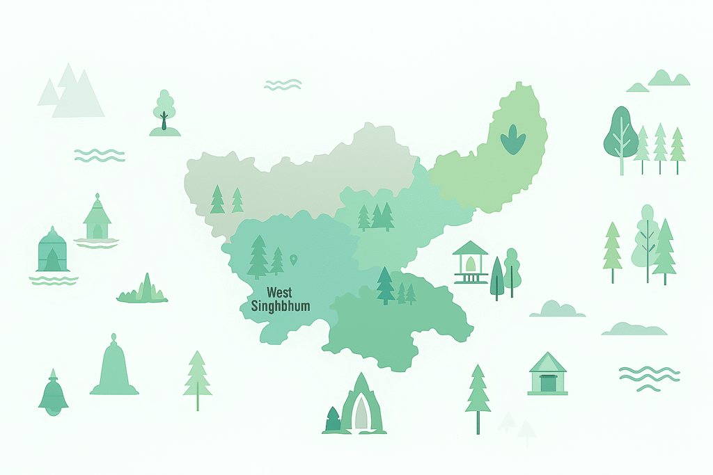
West Singhbhum District Overview
Administrative Details
- Formation Date: 16 January 1990
- Headquarters: Chaibasa
- Area: 7,224 sq. km (Largest in Jharkhand)
- Sub-divisions: 03 – Singhbhum Sadar, Jagannathpur, Podahat
- Blocks: 18 – Chaibasa, Jagannathpur, Manoharpur, Chakradharpur, Manjhari, Jhinkpani, Kumardungi, Khuntpani, Manjhari, Gudri, Bandgaon, Tonto, Anandpur, Sonua, Goilkera, Tantnagar, Noamundi, Majhgaon
- Assembly Constituencies: 05 – Chaibasa, Jagannathpur, Manoharpur, Chakradharpur, Majhgaon
- National Highways: NH 20, 43, 220, 320D, 320G
Demographics
- Population: 15,02,338
- Decadal Growth Rate: 21.75%
- Population Density: 208
- Sex Ratio: 1005 (Highest in Jharkhand)
- Child Sex Ratio: 983
- Literacy Rate: 58.63%
Geography & Resources
- Rivers: Subarnarekha, South Koel, Kharkai, Baitarani, Karo, Koyna, Deo
- Minerals: Iron Ore, Limestone, Manganese, Gold, Copper, Asbestos, Vanadium, Kyanite, Zinc, Chromite, Quartzite
Industries
- Engineering Workshops (Sini)
- ACC Cement Ltd. (Chaibasa)
- Jhinkpani Cement Works
Tourist Attractions
- Saranda Forest – “Home of 700 Hills”
- Hirni Waterfall
- Lupungtu Waterfall
- Jojohatu
- Ramteerth
- Benisagar
- Jaitgarh Fort
- Jagannath Fort
Saranda Forest Facts
- Asia’s densest Sal forest
- Also has Teak, Kusum, Bahera, Arjun, etc.
- Altitude ~1800 ft, Area ~820 sq. km
- Wildlife: Leopard, Elephant, Bear, Boar, Sambar, Cheetal
- Notable Spots: Toybo Waterfall, Royal View Point, Lirgida swamp
- Two-linga Shiva temple called “Nagada Mandir”, and broken-linga Mahadev temple
Religious Sites
- Benisagar Shiva Temple
- Mahadeveshwar Temple
Education
- Kolhan University (Chaibasa)
Seraikela-Kharsawan District Overview
Administrative Details
- Formation Date: 30 April 2001 (carved from West Singhbhum)
- Headquarters: Seraikela
- Area: 2,657 sq. km
- Sub-divisions: 02 – Seraikela & Chandil
- Blocks: 09 – Seraikela, Kharsawan, Ichagarh, Chandil, Gamharia, Kukdu, Nimdih, Rajnagar, Kuchai
- Assembly Constituencies: 03 – Seraikela, Kharsawan, Ichagarh
- National Highways: NH 43, NH 320D
Demographics
- Population: 10,65,056
- Decadal Growth Rate: 25.47%
- Population Density: 401
- Sex Ratio: 956
- Child Sex Ratio: 943
- Literacy Rate: 67.70%
Geography & Resources
- Rivers: Subarnarekha, Kharkai, Karkari, Sanjay
- *City of Seraikela lies on the banks of Subarnarekha River
- Minerals: Gold, Kyanite, Asbestos, Vanadium, Copper, Chromite, Quartzite
Industries
- Seraikela Glass Works Pvt. Ltd.
- Bihar Sponge Iron (Chandil)
Tourist Attractions
- Ichagarh Bird Sanctuary
Important Cultural Notes
- Seraikela’s Singh Deo royal family is the patron of the traditional Chhau dance
Dumka District Overview
Administrative Details
- Formation as district: 1983 (sub-division since 1855)
- Headquarters: Dumka
- Area: 3,761 sq. km
- Sub-division: 01 – Dumka Sadar
- Blocks: 10 – Dumka, Shikaripara, Jarmundi, Jama, Saraiyahat, Ramgarh, Ranishwar, Kathikund, Gopikandar, Masaliya
- Assembly Constituencies: 04 – Dumka, Shikaripara, Jarmundi, Jama
- National Highways: NH 114A, NH 133
Demographics
- Population: 13,21,442
- Decadal Growth Rate: 19.42%
- Population Density: 351
- Sex Ratio: 977
- Child Sex Ratio: 966
- Literacy Rate: 61.02%
Geography & Resources
- Rivers: Mayurakshi, Bansloi, Brahmani, Ajay
- Minerals: Coal, Lead, Limestone, Fireclay, Swartzite, Feldspar
Tourist Attractions
- Masanjore Dam
- Jhumka, Tapatapani, Jhariapani, Tatloi Waterfalls
- Maluti Village – “Village of Temples” / “Gupta Kashi”
- 108 temples originally; 72 remain today (52 Shiva temples)
- Built in 16th century by Basant Rai of Nankar Dynasty
- Famous for terracotta temple architecture
- National recognition: 2nd prize at 2015 Republic Day Parade
Religious Sites
- Basukinath Temple
- Chhoti Nath Idol
Education
- Sido Kanhu University (Dumka)
Etymology
- “Dumka” possibly derives from Santhali word “Sumk” (small) or Persian “Damin-e-Koh” meaning edge of hills
Jamtara District Overview
Administrative Details
- Formation Date: 26 April 2001 (from Dumka)
- Headquarters: Jamtara
- Area: 1,811 sq. km
- Sub-division: 01 – Jamtara
- Blocks: 06 – Jamtara, Nala, Narayanpur, Kundahit, Karmatanr (Vidyasagar), Fatehpur
- Assembly Constituencies: 02 – Jamtara and Nala
- National Highway: NH 419
Demographics
- Population: 7,91,042
- Decadal Growth Rate: 21.12%
- Population Density: 437
- Sex Ratio: 954
- Child Sex Ratio: 954
- Literacy Rate: 64.59%
Geography & Resources
- River: Ajay
- Minerals: Limestone, Quartz, Feldspar
Tourist Attractions
- Mihijam
- Kalyaneshwari Temple
Important Notes
- District with lowest forest area: 101 sq. km
- Lowest forest percentage in Jharkhand: 5.56%
Deoghar District Overview
Administrative Details
- Formation Date: 1 June 1983
- Headquarters: Deoghar
- Area: 2,477 sq. km
- Sub-divisions: 02 – Deoghar and Madhupur
- Blocks: 10 – Deoghar, Madhupur, Sarath, Mohanpur, Karon, Sarwan, Devipur, Palojori, Margomunda, Sanaraythari
- Assembly Constituencies: 03 – Deoghar, Madhupur, Sarath
- National Highways: NH 114A, 133, 333
Demographics
- Population: 14,92,073
- Decadal Growth Rate: 28.03%
- Population Density: 602
- Sex Ratio: 925
- Child Sex Ratio: 950
- Literacy Rate: 64.85%
Geography & Resources
- Rivers: Ajay, Pathra, Jayanti, Mayurakshi, Brahmani
- Mineral: Quartzite
Industries
- Dabur Pharma (Jasidih)
- Hyderabad Industries
Tourist Attractions
- Trikut Hill
- Located ~16 km from Deoghar on Dumka road
- Ropeway built at 840 ft altitude
- Believed to be Ravan’s helipad during Sita’s abduction
- Karon Village
- Ashokan-era village
- Founded by King Mahendra (Ashoka’s son) as a Buddhist vihara
- Contains Ashokan stupas and Buddha statues
- Named after Karna (from Mahabharata); has Karnoswar Temple
- Satsang Nagar
- Established in 1946 by Sri Sri Thakur Anukulchandra
- Includes interfaith temple, museum, zoo, and schools
Religious Sites
- Baidyanath Temple
- Yugal Mandir, Tapovan Temple, Leela Mandir, Kundeshwari, Satsang Nagar
Education
- Hindi Vidyapeeth
Sahebganj District Overview
Administrative Details
- Formation Date: 17 May 1983
- Headquarters: Sahebganj
- Area: 2,063 sq. km
- Sub-divisions: 02 – Sahebganj and Rajmahal
- Blocks: 09 – Sahebganj, Rajmahal, Borio, Barhait, Udhwa, Taljhari, Barharwa, Pathna, Mandro
- Assembly Constituencies: 03 – Rajmahal, Borio, Barhait
- National Highways: NH 33, 133A, 133B
Demographics
- Population: 11,50,567
- Decadal Growth Rate: 24.01%
- Population Density: 558
- Sex Ratio: 952
- Child Sex Ratio: 960
- Literacy Rate: 52.04%
- Second lowest forest area: 203 sq. km (8.22% forest cover)
Geography & Resources
- Rivers: Ganga, Gumani, Brahmani, Bansloi, Palsi, Ajay
- Minerals: Coal, Fireclay, Dimensional Stones, Neelam, Gomeda, Quartzite, Bentonite
Industries
- Metal Press Works
- Tin Can Manufacturing
Tourist Attractions
- Teliagarh Fort
- Rajmahal Fossil Sanctuary
- Udhwa Bird Sanctuary
- Damin-e-Koh Region
- Motijhara Waterfall
- Rajmahal Hills
- Bhagwa Well (Built in 1815 in memory of Edward VII)
Important Notes
- Northernmost district of Jharkhand
- Sahebganj means “Place of the Sahibs” (Sahib + Ganj) – due to British settlements
- Historical mentions in works by Megasthenes and Xuanzang (Huen Tsang)
Godda District Overview
Administrative Details
- Formation Date: 25 May 1983
- Headquarters: Godda
- Area: 2,266 sq. km
- Sub-divisions: 02 – Godda & Mahagama
- Blocks: 09 – Godda, Mahagama, Poriyahat, Meherma, Pathargama, Sundarpahari, Boarijore, Thakurgangti, Basantrai
- Assembly Constituencies: 03 – Godda, Mahagama, Poriyahat
Demographics
- Population: 13,13,551
- Decadal Growth Rate: 25.35%
- Population Density: 580
- Sex Ratio: 989
- Child Sex Ratio: 975
- Literacy Rate: Not mentioned directly in this part
Geography & Resources
- Minerals: Coal, Lead, Feldspar
Tourist Attractions
- Barakopa Hill
Religious Sites
- Maa Yogini Temple (on Barakopa Hill)
Pakur District Overview
Administrative Details
- Formation Date: 28 January 1994
- Headquarters: Pakur
- Area: 1,811 sq. km
- Sub-division: 01 – Pakur
- Blocks: 06 – Pakur, Maheshpur, Littipara, Hirapur, Pakuria, Amrapara
- Assembly Constituencies: 03 – Pakur, Maheshpur, Littipara
- National Highways: NH 133A, 333A
Demographics
- Population: 9,00,422
- Decadal Growth Rate: 28.33%
- Population Density: 497
- Sex Ratio: 989
- Child Sex Ratio: 975
- Literacy Rate: 48.82%
- Lowest overall literacy rate in Jharkhand
- Male Literacy: 57.06%
- Female Literacy: 40.52%
- Lowest SC population: 3.16%
Geography & Resources
- Rivers: Sundar, Mayurakshi, Brahmani, Bansloi, Ganga
- Minerals: Coal, Fireclay, Gomeda (precious stone)
Tourist Attractions
- Baramasia
- Shivpur Hot Spring
- Ali Ganj Small Fort
- Birkhata Fort
Important Notes
- Easternmost district of Jharkhand
- Known for stone chips and black stone mining